SHEET 3 Northern Ireland 1:250:000 Chart - Edition 14
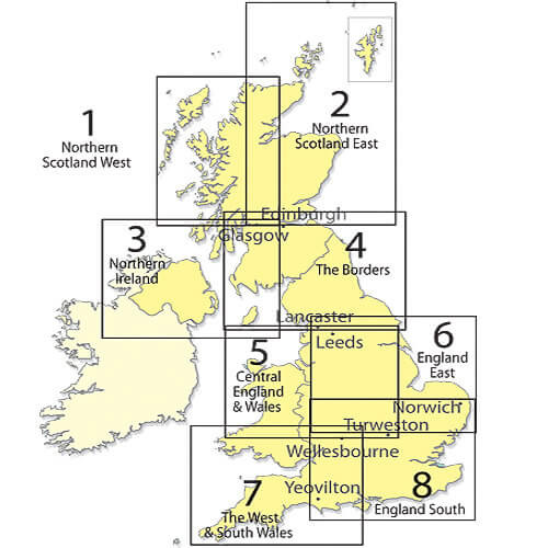
SHEET 3 Northern Ireland 1:250:000 Chart - Edition 14
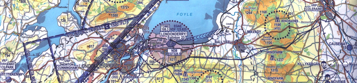
The CAA Northern Ireland 1:250 000 aeronautical Chart is produced as part of the CAA chart series and serves the requirements of VFR in-flight navigation and flight planning for low speed, short or medium range operations at low and intermediate altitudes.
NEW Edition 14 In Stock Now! Effective 4th September 2025
The Northern Ireland 1:250 000 chart shows a more detailed topographical base than the CAA 1:500 000 scale charts and are particularly well suited to the General Aviation pilot who operate at low level. The CAA 1:250 000 chart depicts Airspace information up to FL50 (5000ft AMSL) and obstacles above 300ft AGL. Each Charts Displays: Controlled Airspace (Military & Civil) depicted to Alt 5000ft or FL50. Terrain contours above 200ft AMSL. Obstacles above 300ft AGL, Airfield ICAO idents Radio initial contact frequencies. In addition to aeronautical information, the charts provide hydrographic, topographic, cultural and other visual features compatible with legibility at the scale of the chart, this information is supplied by GB Ordnance Survey and/or Ordnance Survey Northern Ireland.