European Aerodromes North 1:2 500 000 Chart - Roger Data


European Aerodromes North 1:2 500 000 Chart - Roger Data
***Current Edition Valid from 2017– No Update for 2022***
European Aerodromes North Rogers Data chart – panoramachart
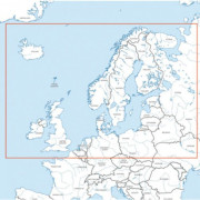
The Europe Aerodrome Panorama chart is a designed for preparing flights to European destinations or alternates and calculating flight times and ranges.
It shows european aerodromes and contains important topographical information. This extremely detailed map includes hundreds of airports both civil and military, IFR and VFR. It is ideal to get an overview for preliminary flight planning. Urban areas, terrain contours, topographical features including bodies of water and more.
This chart is perfect for commercial pilots for whom position is just a symbol on an FMC or MCDU. It is also ideal for passengers or for pilots planning a long distance international trip.
Panorama map on a scale of 1:2.500.000 features:
- Aerodromes with ICAO code
- Colourful and accurate
- Urban areas
- International borders
- VFR and IFR aerodromes
- Dimensions 137.5cm x 94cm