Norway South VFR 1:500 000 Chart - Rogers Data

33% OFF

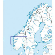
Norway South VFR 1:500 000 Chart - Rogers Data
Code : RD5045
This Rogers Data VFR ICAO aeronautical chart for Southern Norway gives a very detailed description of the respective airspace. The shading and relief on these highly sophisticated topographic terrain charts creates a dynamic 3D-effect.
All Rogers Data ICAO VFR aeronautical charts are based on the latest aeronautical information from AIP (Aeronautical Information Publication) and their supplements of the CAA (Civil Aviation Authority) as well as on the relevant regulation of ICAO Annex (Aeronautical Charts) and European Commission Regulations.
- Laminated Aeronautical chart on a scale of 1:500,000
- According to ICAO Annex 4; EU-Commission Regulations; AIP
- Clear representation of the ATS airspace structure
- Detailed highly sophisticated terrain map with shading and relief
- Airports, aerodromes and heliports with additional information
- Radio Navigation Aids with name, frequency and morse code
- Compulsory reporting points, reporting points on request, border crossing points
- Danger- and restricted areas
- Obstacles or groups of obstacles
- Minimum grid area altitude
- Isogonic line model with magnetic variation
- Aerial sporting and recreational activities
- Areas with sensitive fauna