
London Helicopter ROUTE Chart

London Helicopter ROUTE Chart
Code : 5798F
The CAA London Heli-route chart is a 1:50k chart designed for visual air navigation for helicopters within the London area. The London Heli Chart shows the current helicopter routes into and out of the area, Heliports, Altitude Limits and reporting points
EDITION 21 - Release Date 03/10/2024
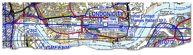
In addition to aeronautical information, the chart provides hydrographic, topographic, cultural and other visual features compatible with legibility at the scale of the chart. The source for all topographical detail is the GB Ordnance Survey 1:50,000 Landranger Map Series.
You will find a printable version of the Legend here.