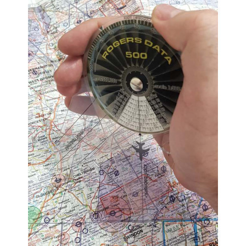
Rogers Data VFR Charts

Rogers Data Charts cover almost every country in Europe. These high resolution ICAO VFR aeronautical charts provide a very detailed description of the airspace in each country with highly sophisticated topographic terrain. All Rogers Data charts are updated annually with the latest aeronautical information from Civil Aviation Authority AIP's and supplements as well as taking into account the relevant regulations of the ICAO Annex (Aeronautical Charts) and European Commission Regulations.

Poland North VFR 1:500 000 Chart - Rogers Data

Code: RD5029
£26.75 Inc VAT (£26.75 Ex VAT)
*** NEW 2024 Edition Available. Order Now! *** This Rogers Data VFR ICAO aeronautical chart for Northern Poland gives a very detailed description of the respective...

Poland South East VFR 1:500 000 Chart - Rogers Data

Code: RD5030
£22.27 Inc VAT (£22.27 Ex VAT)
*** NEW 2024 Edition Available. Order Now! *** This Rogers Data VFR ICAO aeronautical chart for the South East of Poland gives a very detailed description of the re...

Poland South West VFR 1:500 000 Chart - Rogers Data

Code: RD5031
£22.27 Inc VAT (£22.27 Ex VAT)
*** NEW 2024 Edition Available. Order Now! *** This Rogers Data VFR ICAO aeronautical chart for the South West of Poland gives a very detailed description of the re...

Malta & Sicilia VFR 1:500 000 Chart - Rogers Data

Code: RD5032
£22.27 Inc VAT (£22.27 Ex VAT)
*** NEW 2024 Edition Available. Order Now! *** This Rogers Data VFR ICAO aeronautical chart for Malta and Sicily gives a very detailed description of the respective...

European Aerodromes South 1:2 500 000 Chart - Rogers Data

Code: RD5033
£26.75 Inc VAT (£26.75 Ex VAT)
***Current Edition Valid from 2017– No Update for 2022*** European Aerodromes South Rogers Data chart – panoramachart

European Aerodromes North 1:2 500 000 Chart - Roger Data

Code: RD5034
£26.75 Inc VAT (£26.75 Ex VAT)
***Current Edition Valid from 2017– No Update for 2022*** European Aerodromes North Rogers Data chart – panoramachart

1:500 000 Navigation Plotter - Rogers Data

Code: RD5036
£41.35 Inc VAT (£34.46 Ex VAT)
Rogers Data Navigation Plotter 500 for charts with a scale of 1:500,000. Simply place the two points on the chart and read distance and flight-time directly from the plotter.

1:250 000 Navigation Plotter - Rogers Data

Code: RD5035
£40.66 Inc VAT (£33.88 Ex VAT)
Rogers Data Navigation Plotter 250 for charts with a scale of 1:250,000